Like a number of small towns across during the 20th century, West Boylston, Massachusetts was forced to rebuild itself when the Metropolitan District Commission decreed in the late 1800s that parts of the town (and neighboring Boylston, Sterling and Clinton) would have to be taken for a reservoir for Boston and the rest of eastern Massachusetts.
|
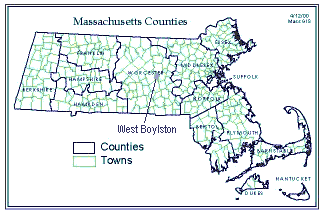
Location of West Boylston in Massachusetts, courtesy of Massachusetts Geographic Information System (MassGIS) |
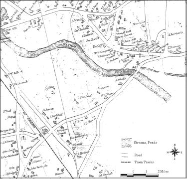
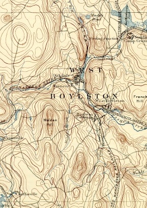
In the 1800s, West Boylston was a mill town in the Nashua River Valley:
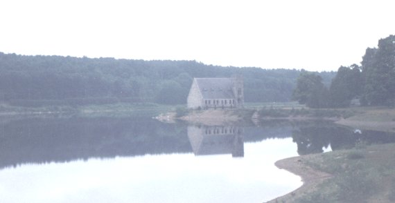
The Massachusetts Disctrict Comission chose the Nashua River valley as the basin for the Wachusett Reservoir in the mid-1890s. Over ten years was spent moving people out of the valley and demolishing the town. While a few structures were moved, none remained in their original location except for the Baptist Church (now called the Old Stone Church):
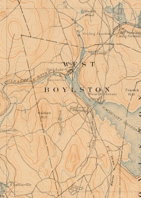
Here are "before" and "after" maps of the West Boylston area.
|
|
|
| Topological Map of West Boylston, 1892 (before the reservoir construction), courtesy of the University of New Hampshire | Topological Map of West Boylston, 1917 (after the reservoir construction), courtesy of the University of New Hampshire | |
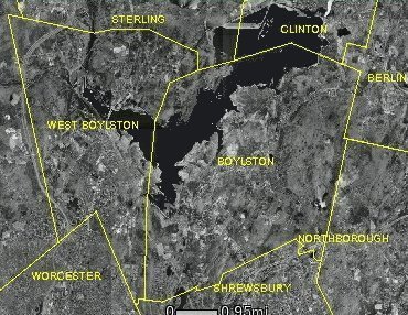 |
Current aerial view of the Wachusett Reservoir, courtesy of Massachusetts Geographic Information System (MassGIS) |
| Document: Maps of West Boylston Over Time Web URL: http://dpsinfo.com/wb/mapscape.html Updated: 03/21/2019 09:51:17
| |||||||
|  | ||||||